Coastal Hazards
Coastal hazard mitigation is identified as a high priority for NANOOS by our users and stakeholders. NANOOS is dedicated to contributing information for three of these identified areas to assist with disaster reduction in our region:
- Providing hazard and disaster information where and when it is needed;
- Understanding the natural processes that produce hazards; and
- Promoting risk-wise behavior.
NANOOS achieves this by providing essential observations and better decision support tools for coastal managers, planners and engineers to improve coverage and accuracy. Products and information provided currently include observations and analysis of topographic beach profiles, shoreline change, nearshore bathymetry, sea level change, and waves to:
- Improve planning and response to coastal hazards;
- Assist with engineering design;
- AAid with research on impacts of extreme events on the coast; and
- Track shoreline change in specific communities.
Areas of Emphasis
Maritime Operations |
Coastal Hazards |
Fisheries & Marine Life |
Marine Ecosystems |
Weather & Climate |
Related Topics
Coastal & Marine Spatial Planning
Honshu Earthquake and Tsunami 2011
An informational page about the magnitude 9.0 earthquake that occurred off the eastern coast of Japan on March 11, 2011, and the resulting tsunami that hit the US Pacific Northwest 9 hours later.
Marine Debris
Related NANOOS Products
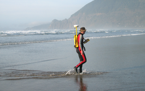
Pacific Northwest Beach and Shoreline Mapping
Beach Cross-section and time-series plots of coastal change occuring on the Oregon coast due to the effects of storms, El Niños, changes in beach sediment supply, and sea level rise.
Southwest Washington Coastal Mapping
Beach cross-sections, time-series plots of coastal change, and information on beach sediments for the Columbia River littoral cell (Tillamook Head, Oregon to Pt. Grenville, Washington).
Coastal Processes in the Pacific Northwest
Information on beach dynamics, waves, storms, and climate change that affect the PNW beaches, shorelines, and hazards.
Tsunami Evacuation Zones on the Washington and Oregon Coasts
Tsunami evacuation maps resutling from potentially great (magintude 9+) earthquakes on the Cascadia subduction zone.
NANOOS Visualization System (NVS)
The NANOOS Visualization System (NVS) provides easy access to forecast and observation data across a wide range of assets such as buoys, shore and land stations, high-frequency radar, and satellites.
Wave Forecasts
Significant Wave Height & Direction and Wind Speed & Direction forecasts for the Pacific NW. Forecasts are updated every 6 hours starting at 13:00 PDT.
Ocean Currents
Daily average ocean surface currents off the Oregon coast. These surface currents are measured with a radio transmitter and receiver using an instrument, the SeaSonde, made by CODAR Ocean Sensors.
NANOOS members involved in this effort include:
Oregon Dept. of Geology & Mineral Industries
| National Observing System Partners Alliance for Coastal Technologies (ACT) Southeastern Universities Research Association (SURA) Integrated Ocean Observing System IOOS | |||||||