
Marine Ecosystems
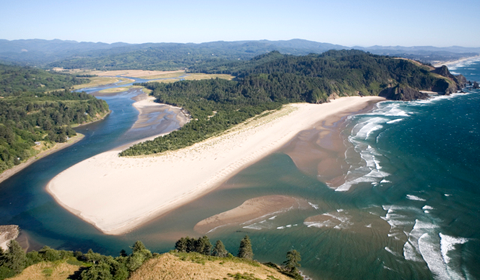
The waters of the Pacific Northwest, its coast and estuaries, support a wide range of vital activities and are critically important to the societal and ecological health of the region. They modify and moderate regional weather, are a reservoir for bountiful natural resources, provide a rich environment for aquaculture activities, and are the source of cultural identity to many residents. In order to maintain, monitor, and protect the long-term sustainability and health of this marine ecosystem – including its habitats, functions and abundant resources – there must be a concerted and systematic approach to understanding and managing the complexities of the system.
Roles that ocean observing systems fill is making sustained or more frequent observations of biological, chemical, and physical ocean characteristics using a whole suite of technologies, including buoys, gliders, satellites, and boats. The greater number of observations over time and space allow us a better understanding that we may not have otherwise of the interactions and processes that are occurring hourly, daily, and annually. With the information we gather from observatories, we will have a more rapid detection and timely prediction of a broad spectrum of ocean and atmospheric conditions, especially of changes in those conditions that impact society.
Areas of Emphasis
Maritime Operations |
Coastal Hazards |
Fisheries & Marine Life |
Marine Ecosystems |
Weather & Climate |
Related Topics
Ocean Acidification
Harmful Algal Blooms
Coastal and Estuarine Hypoxia
Water Quality for Shellfish Growers
Marine Debris
Coastal & Marine Spatial Planning
Related NANOOS Products
CRITFC Coastal Margin Observation and Prediction Program (CMOP)
Near real-time data, forecasts, and climatological maps of physical and biogeochemical parameters in the Columbia River estuary, near plume, and coastal margins of Oregon and Washington.
High-Frequency (HF) Radar Surface Currents
Observations of daily averaged ocean surface current speed and direction for the Oregon coast.
NANOOS Visualization System (NVS)
The NANOOS Visualization System (NVS) provides easy access to forecast and observation data across a wide range of assets such as buoys, shore and land stations, high-frequency radar, and satellites.
OSU Regional Ocean Modeling System (ROMS) Surface Fields
Forecast map of water temperature and surface currents for the Oregon and SW Washington Coast.
Puget Sound Networked Profiling Buoy
Data from a profiling buoy located at Point Wells (north of Seattle). The sensor package measures a depth profile of oceanographic variables every hour from the sea surface to the sea bed.
Puget Sound ORCA
Oceanic Remote Chemical Analyzer (ORCA) measures physical, chemical, and biological water characteristics in Hood Canal.
Salish Cruise Data
Over ten years of processed PRISM cruise data starting in December 1998 to most recently processed from numerous Puget Sound locations. Data types include fluorescence, salinity, density, water temperature, transmissivity, and oxygen.
Water Quality Data for Shellfish Growers
Real-time Water Quality Data for Shellfish Growers. A pilot project between NANOOS and the National Estuarine Research Reserve System.
NANOOS members involved in this effort include:
Oregon Health and Sciences University
VENUS Observatory, Ocean Networks Canada
Western Association of Marine Laboratories
NOAA Olympic Coast National Marine Sanctuary
Oregon Dept. of Land Conservation & Development
| National Observing System Partners NSF Ocean Observing Initiative (OOI) National Estuarine Research Reserve System (NERRS) Olympic Coast National Marine Sanctuary (OCNMS) National Data Buoy Center (NDBC) Coastal Data Information Program (CDIP) Integrated Ocean Observing System IOOS | |||||||